
Taylor Geospatial backs three geoAI projects to fight hunger
By AI, Created 5:55 PM UTC, May 22, 2026, /AGP/ – Taylor Geospatial has selected three awardees for its Geospatial Innovation for Food Security Challenge, funding tools that aim to improve early warning, conflict-zone planning and precision agriculture. The 18-month projects are designed to turn geospatial data into usable intelligence for humanitarian agencies, governments and farmers.
Why it matters: - The projects are designed to close the gap between geospatial research and tools that frontline decision-makers can actually use. - The work targets food insecurity, conflict disruption and inefficient farm inputs, which can affect hunger, costs and agricultural stability. - Taylor Geospatial is pairing researchers with practitioners to move GeoAI from proof of concept toward operational deployment.
What happened: - Taylor Geospatial announced three awardees for the Geospatial Innovation for Food Security Challenge on May 27, 2026. - The nonprofit selected projects focused on early warning for hunger, food system instability and precision agriculture. - Each team will receive up to $550,000 in funding plus expert guidance and support. - The projects will move through an 18-month period toward full operational deployment.
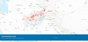
The details: - The United Nations World Food Programme and the REACH Initiative are developing Afghanistan’s PULSE platform, short for Platform for Understanding Local Shocks and Emergencies. - AF-PULSE tracks hazards that affect food access and supply routes and combines climate, food security, nutrition and market data. - The system is designed to help responders plan when ground-level data is incomplete. - GeoAI models trained by rapid assessment feeds, along with community feedback, are intended to forecast supply chain disruptions and identify alternate transport routes. - The WFP Afghanistan research team said AF-PULSE could reduce hunger and malnutrition from escalating into famine-like conditions during conflict and disasters. - The project’s methodology is meant to serve as a template for other conflict-affected countries. - Arizona State University, the University of Maryland and Washington University in St. Louis are collaborating with NASA Harvest, NASA’s Goddard Space Flight Center and FEWS NET on a GeoAI capability to identify early signals of food system instability. - The tool aligns in-season satellite-based embeddings with natural-language queries so users can ask question-driven questions and receive accessible insights while uncertainty is shown explicitly. - A FEWS NET analyst could, for example, ask which fields have been prepared and get a map plus an estimate such as about 80% prepared, with confidence information. - The open-source tool is planned for testing in Sudan, Ukraine, Syria and Haiti. - The framework is intended to lower technical barriers across the GeoAI and food security communities. - University of Missouri researchers, working with MU Extension, are developing a “water first” GeoAI model to improve nitrogen application decisions. - The model combines satellite imagery and machine learning to map plant-available soil water at sub-field scales. - The initial open-source version is being built for rainfed arable farms in the U.S. Midwest, with a focus on claypan soils in Missouri and Iowa. - The model is designed to adapt to regions with similar agricultural systems and soils globally.
Between the lines: - The selection signals a shift toward tools that deliver usable outputs under real-world constraints such as time, uncertainty and limited data. - The mix of humanitarian and farm-management use cases suggests Taylor Geospatial sees GeoAI as infrastructure for both crisis response and agricultural efficiency. - The open-source approach in two of the projects could make adoption easier outside the original test regions if the tools prove reliable.
What’s next: - The awardees will continue development as they move from proof of concept to operational deployment. - The Afghan, conflict-zone and Midwest pilot work will test whether the tools can perform across different data environments and on-the-ground conditions. - Taylor Geospatial says the projects are built to be adaptable, which could open the door to use in other countries and agricultural systems.
The bottom line: - Taylor Geospatial is betting that better geospatial tools can help humanitarian teams spot food crises earlier and help farmers make better decisions before problems spread.
Disclaimer: This article was produced by AGP Wire with the assistance of artificial intelligence based on original source content and has been refined to improve clarity, structure, and readability. This content is provided on an “as is” basis. While care has been taken in its preparation, it may contain inaccuracies or omissions, and readers should consult the original source and independently verify key information where appropriate. This content is for informational purposes only and does not constitute legal, financial, investment, or other professional advice.
Sign up for:
Sudan Industry Press
The daily local news briefing you can trust. Every day. Subscribe now.
Check Your Email!
We sent a one-time activation link to: .
Confirm it's you by clicking the email link.
If the email is not in your inbox, check spam or try again.
Welcome back!
is already signed up. Check your inbox for updates.